A simple question over coffee — “Wouldn’t it be wonderful if blind people could feel where they live?” — has grown into a remarkable community collaboration in Tauranga.
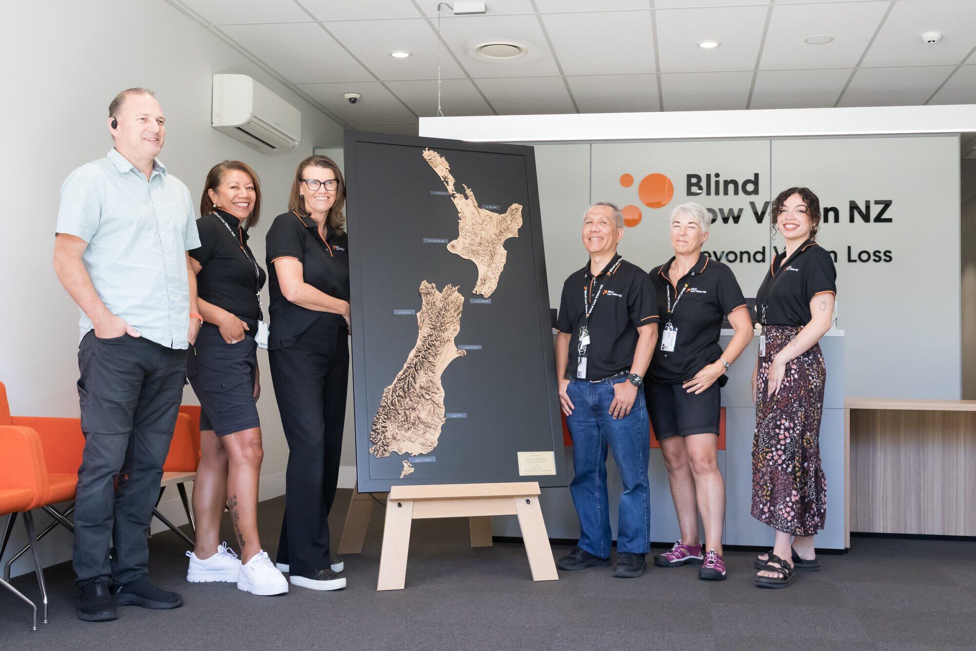
The result is a large, three-dimensional wooden map of New Zealand, now gifted to Tauranga’s Blind Low Vision NZ, allowing people to trace mountain ranges, follow coastlines and experience the shape of Aotearoa through touch.
The idea began two years ago when Tracy Hampton of Halo Productions was talking with a friend and caregiver about the people she supports, including a young blind girl. The pair reflected on how powerful it would be for someone without sight to physically explore the land they call home.
“I began researching tactile mapping solutions,” Hampton said.
“That’s when I found Tides Out Maps.”
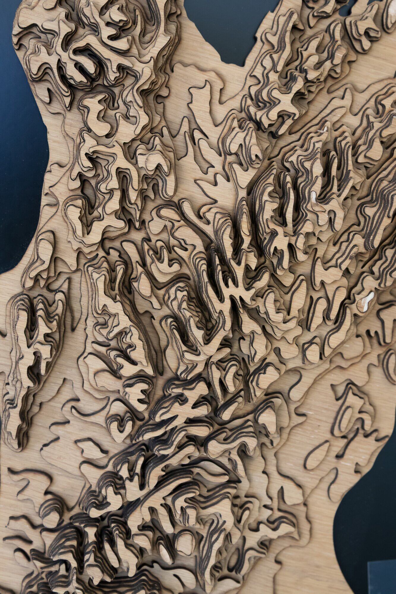
Close up of the three-dimensional wooden Tides Out Map of New Zealand. Photo / Kelly O’Hara
The business — run by young couple Kate Spence and Matt Peacock — creates intricate, layered wooden maps that capture the topography of New Zealand in striking detail.
Each piece is precision-cut and meticulously assembled from more than 1000 individual components. Retailing at about $2500, the maps represent hundreds of hours of work.
Spence said the couple first created the maps out of curiosity and creativity. Peacock, an engineer and keen free diver, began experimenting with layered designs while working with a laser cutter.
“We never really thought about them being used by the blind,” Spence said.
“But at markets, kids always run up wanting to touch them. Adults do too — they just stop themselves. Over time we realised they’re such an amazing educational tool.”
Hampton first approached the couple in 2023, but at the time no map was available.
Two years later, they revisited their records and contacted her with an offer: they would donate one of their original large-scale New Zealand prototypes.
“We had it at home and weren’t going to give it to anyone,” Spence said.
“But we thought it would be really awesome to donate it. The timing just worked out perfectly.”
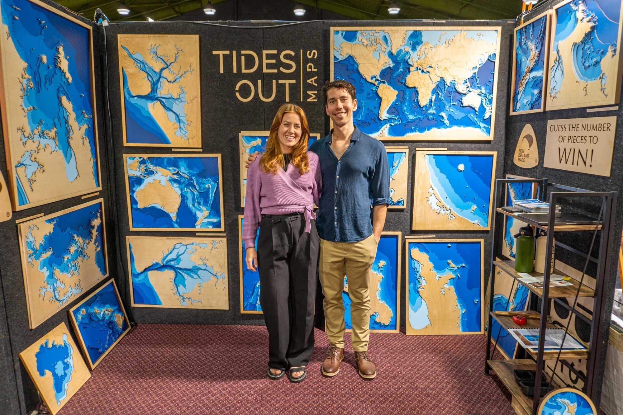
Kate Spence and Matt Peacock of Tides Out Maps. Photo / Supplied
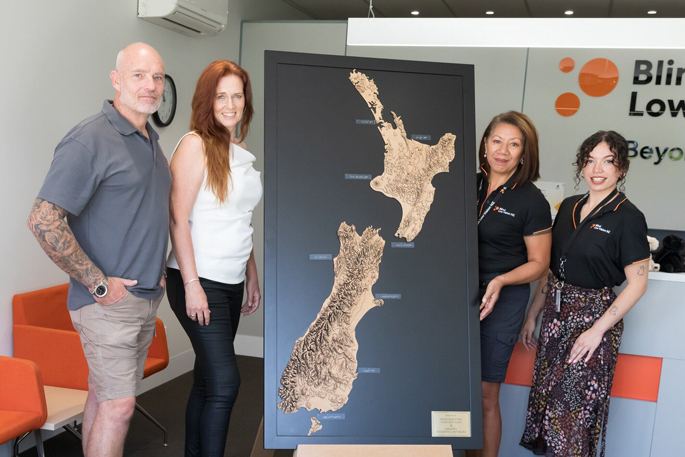
The prototype arrived in separate sections — the North and South Islands, along with Stewart Island — without a backing board. That’s where Hampton’s partner, Sean Wood of Creative Kitchens & Interiors, stepped in.
Wood and his team repaired minor damage, carefully aligning the islands using precision spacing stencils so the Cook Strait and southern waters sit at exact distances. He then mounted the map on to a sleek, dark backing board and built a custom easel for display.
The darker background was a deliberate choice. While Tides Out Maps often use a lighter ocean-blue base, the deep contrast allows people with limited sight to distinguish the outline of the country more clearly.
When Nancy Paviour-Smith first visited to feel the map, she was moved.
“It’s wonderful. Fancy someone going to all that trouble making a map like that,” she said.
Paviour-Smith, who is gradually losing her sight, learned Braille years ago while raising her daughter, who was blind from birth.
For this project, she used her Braille machine to label key cities including Auckland, New Plymouth and Tauranga.
Working with Hampton, each clear Braille label was carefully positioned so it could be read by touch without detracting from the map’s visual appeal.
The process required precision — particularly for longer place names such as Christchurch and Invercargill — and careful consideration of commonly taught Braille formats to ensure accessibility for most readers.
“She knows Braille both by sight and by feel,” Hampton said.
“Learning it visually for her daughter is different from reading it now through touch. It’s been quite a journey.”
Andrew Law, Sefulu Calvert, Kelly McBride, Neil Viduya, Sally Browne and Shyanne Erueti with the Tides Out Map at Blind Low Vision NZ. Photo / Kelly O’Hara.
The completed piece is both artwork and interactive educational tool — a sensory experience that connects people to the land in a new way.
For Paviour-Smith, who spent a lot of life in Dunedin, the experience was deeply personal. On her first visit, her hands went straight to the mountain ranges of the lower South Island.
The map has been installed in the reception area of Tauranga’s Blind Low Vision NZ, where clients can explore it freely. Hampton hopes the concept might eventually be replicated at other centres nationwide.
Spence said the couple are grateful the map will be used in a meaningful way.
“We’re just stoked that it can go on to do good,” she said. “It was Tracy’s idea and her drive that made it happen. Not many people have that full power to think of something and then execute it.”
Hampton said what began as a conversation “has grown into something tangible”, a handcrafted reminder that connection to place is not limited to sight.
“To know that people who cannot see our country can now experience it through touch is incredibly special to us both,” Wood said.